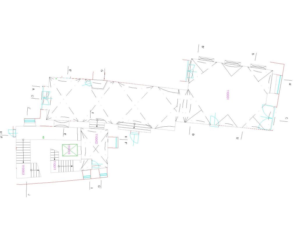
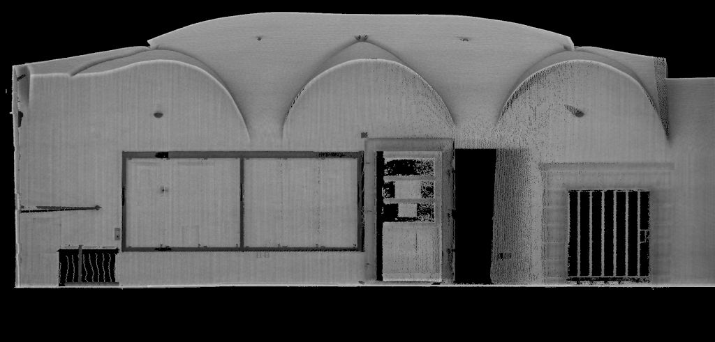
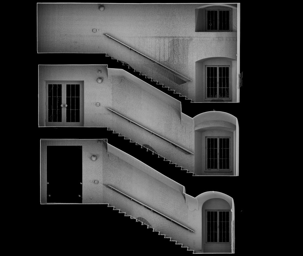
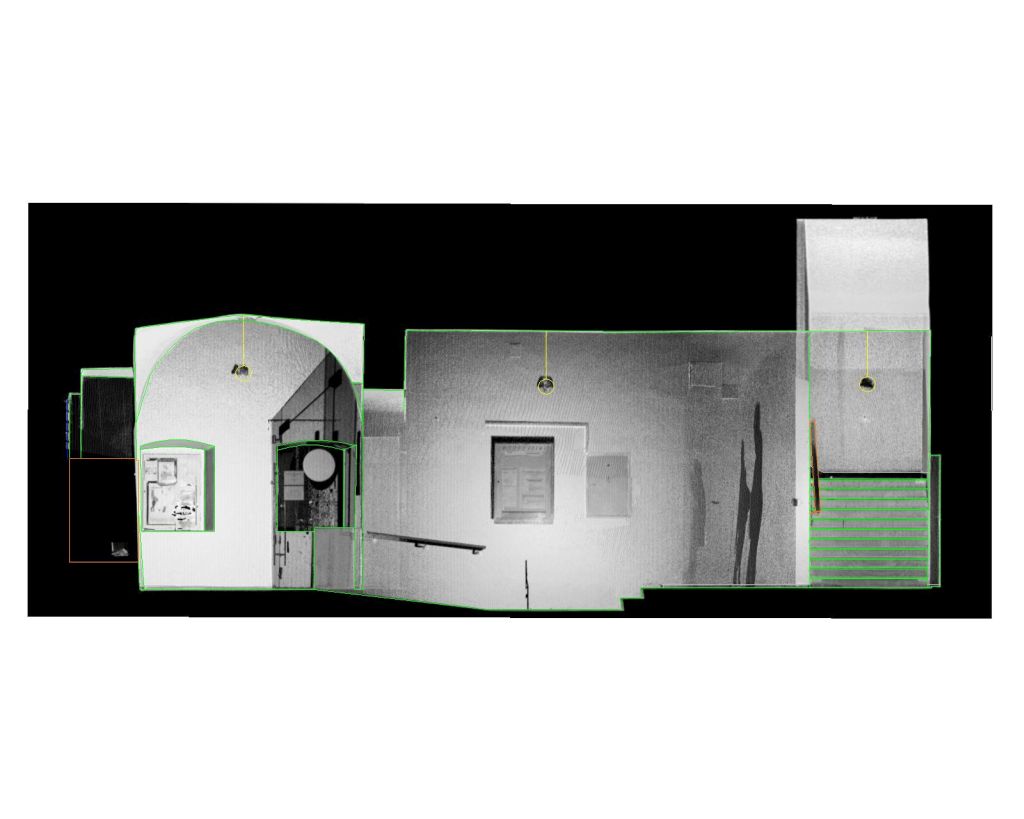
A geodetic survey of internal routes (this involved more than 3 km of corridors) in the listed buildings of the Carolinum in the centre of Prague – this is a complex of interconnected buildings of different ages (from the 14th century – 20th century), a total of 5 above ground floors. The survey was carried out using the digital photogrammetry method and laser scanning in combination with conventional geodetic methods. The output was floor plans, orthophoto plans of the corridor walls and views of walls processed in the form of 2D drawings.